- Assam to stop first doses of Covaxin again due to vaccine shortage
- When will schools reopen: Himachal wants to reopen colleges but Delhi, Assam focus on online classes [state-wise details]
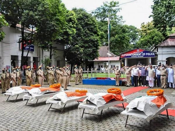
Five Assam police personnel were killed on Monday after the police forces of Assam and Mizoram exchanged gunshots in a violent clash at the disputed border. The clashes between the states are not rare incidence.
Last year in October, the residents of these states had been engaged in a brawl for territory in which at least eight people were injured and a few huts and small shops were burned down. In 1994, the first border dispute erupted, prompting multiple rounds of negotiations at the federal and state levels. Sporadic skirmishes continued, but Monday's escalation was extraordinary with the killing of 5 police personnel of Assam.
Origin of Mizoram as a state
In 1972, Mizoram was created as a Union Territory from Assam. It became a full-fledged state in 1987. Cachar, Hailakandi, and Karimganj are three South Assam districts that share a 164.6-kilometer border with Mizoram's Kolasib, Mamit, and Aizawl districts. Much of the boundary runs through thickly forested slopes towards the southern extremity of Assam, where the Mizo hills meet the Barak Valley.

What is the boundary dispute?
Confrontations between Assam and Mizoram inhabitants are less common in the Northeast's intricate boundary equations than, Assam and Nagaland citizens. Nonetheless, the current 165-kilometer border between Assam and Mizoram dates back to the British Ear, when Mizoram was known as Lushai Hills, an Assam region.
After killing 5 Assam police personnel and injuring many , this is how Mizoram police and goons are celebrating.- sad and horrific pic.twitter.com/fBwvGIOQWr
— Himanta Biswa Sarma (@himantabiswa) July 26, 2021
The controversy comes from two notifications: One from 1875 that distinguished the Lushai Hills from the Cachar plains. In the North East, the Act separated the hills from the plains and valleys, limiting free movement between the two zones. The hills were designated as "excluded areas." Another source of conflict is a notification in 1933 that established a border between the Lushai Hills and Manipur.

The difference in perception in boundary
The notion of the border in Mizoram is based on a notification issued in 1875 as a result of the Bengal Eastern Frontier Regulation Act of 1873. In contrast, Assam follows a state government declaration from 1933 that demarcates the Lushai Hills, as Mizoram was then known, from the province of Manipur.


!['Had denied Housefull franchise as they wanted me to wear a bikini': Tia Bajpai on turning down bold scripts [Exclusive]](https://data1.ibtimes.co.in/en/full/806605/had-denied-housefull-franchise-they-wanted-me-wear-bikini-tia-bajpai-turning-down-bold.png?w=220&h=138)


