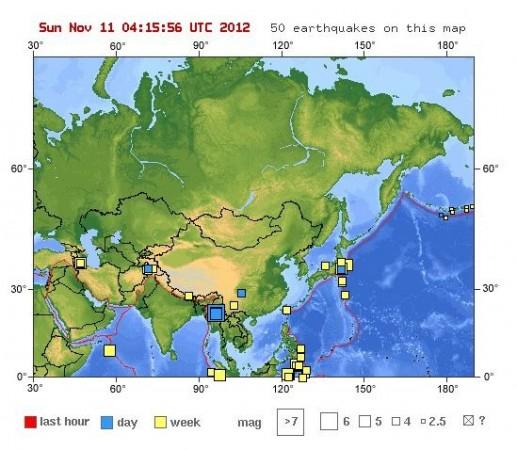
A strong earthquake of magnitude 6.8, followed by two milder shock, rocked Myanmar on Sunday morning.
The U.S. Geological survey (USGS) said that quake occurred at around 07:42:38 am local time on Sunday and had a depth of 9.8 km (6.1 miles). The quake was centred 56 km (34 miles) NNE of Shwebo, 59 km (36 miles) WNW of Mogok, 117 km (72 miles) N of Mandalay and 123 km (76 miles) NNW of Maymyo.
Initially, the USGS reported it to be 6.6 and later revised the magnitude to 6.8. Two milder earthquakes of magnitude 5.0 struck Myanmar about 20 minutes later and both hit the epicenter at a depth of 10.1 km (6.3 miles).
There were no immediate reports of damage and injuries. Residents from Mandalay, the second-largest city and the last royal capital of Burma, told Reuters that they experienced a very strong quake at about 7:30 a.m.
"I've never felt such strong tremor. I also heard some loud noises and the light went out. No idea about the damage," a local resident said.
Mandalay Meteorological Department told the news agency that the quake hit the west bank of Ayeyawaddy River, Myanmar's largest river and most important commercial waterway. The department had not yet received reports of any damage.
Residents in Bangkok, capital of neighbouring Thailand, also felt the strong quake. The quake occurred just a week ahead of US President Barack Obama's visit to Myanmar.


