1 of 10

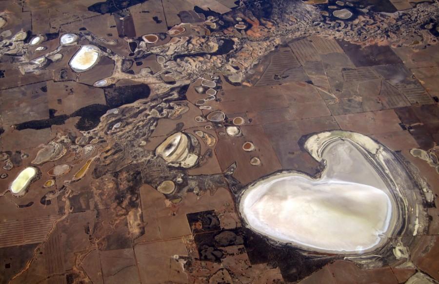
Salt pans and small dams can be seen in drought-affected farming areas located on the outskirts of the Western Australian capital city of Perth.
Credit: Reuters
2 of 10

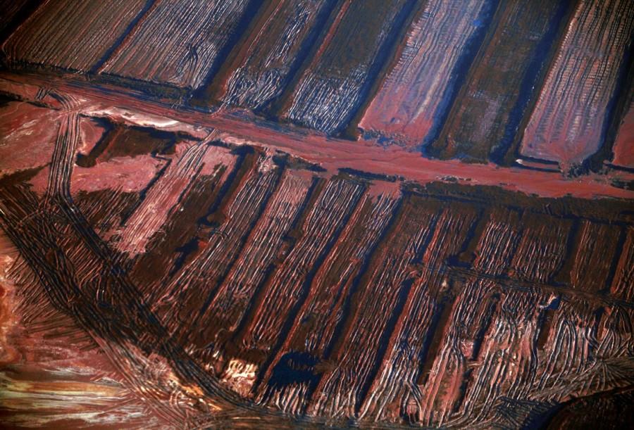
Mining operations can be seen at the Rio Tinto alumina refinery and bauxite mine in Gove, also known as Nhulunbuy, in Australia's Northern Territory.
Credit: Reuters
Advertisement1
3 of 10
![The Indigenous Australian community of Mutitjulu can be seen on the eastern side of Uluru, also known as Ayers Rock, in this aerial photo taken in the Northern Territory, Australia. Australia from the air,Australia from air,Australia from above,Australia,Awesome Australia,Australia from above pics,Australia from above images,Australia from above photos,Australia from above stills,Australia from above pictures]()
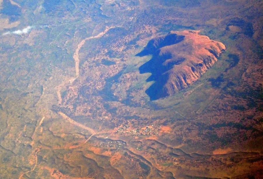
The Indigenous Australian community of Mutitjulu can be seen on the eastern side of Uluru, also known as Ayers Rock, in this aerial photo taken in the Northern Territory, Australia.
Credit: Reuters
4 of 10
![A general view of a road next to sand dunes covered in vegetation in the Pilbara region of Western Australia. Australia from the air,Australia from air,Australia from above,Australia,Awesome Australia,Australia from above pics,Australia from above images,Australia from above photos,Australia from above stills,Australia from above pictures]()
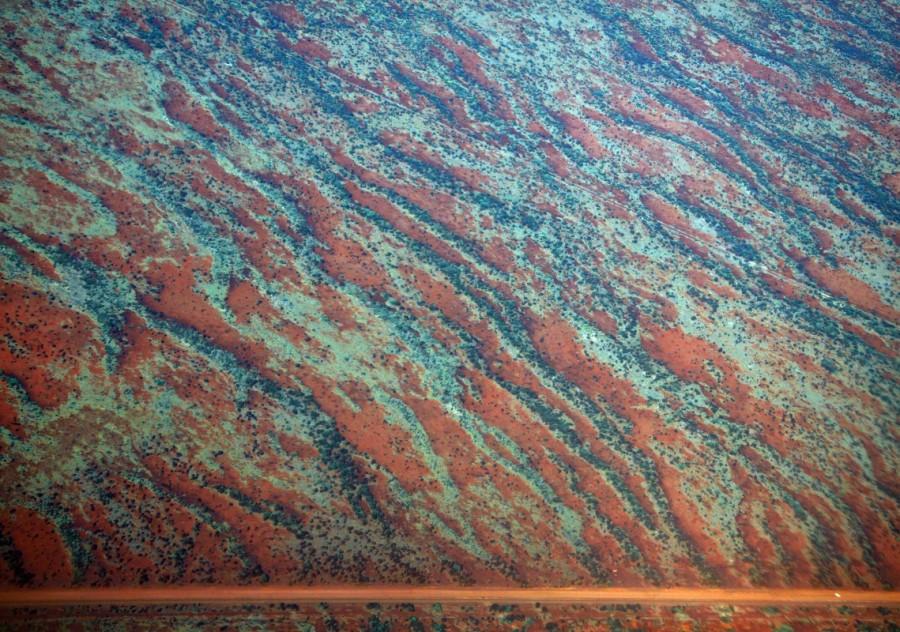
A general view of a road next to sand dunes covered in vegetation in the Pilbara region of Western Australia.
Credit: Reuters
5 of 10
![Salt pans and dams can be seen in farming areas located near Perth, in the southern region of Western Australian. Australia from the air,Australia from air,Australia from above,Australia,Awesome Australia,Australia from above pics,Australia from above images,Australia from above photos,Australia from above stills,Australia from above pictures]()
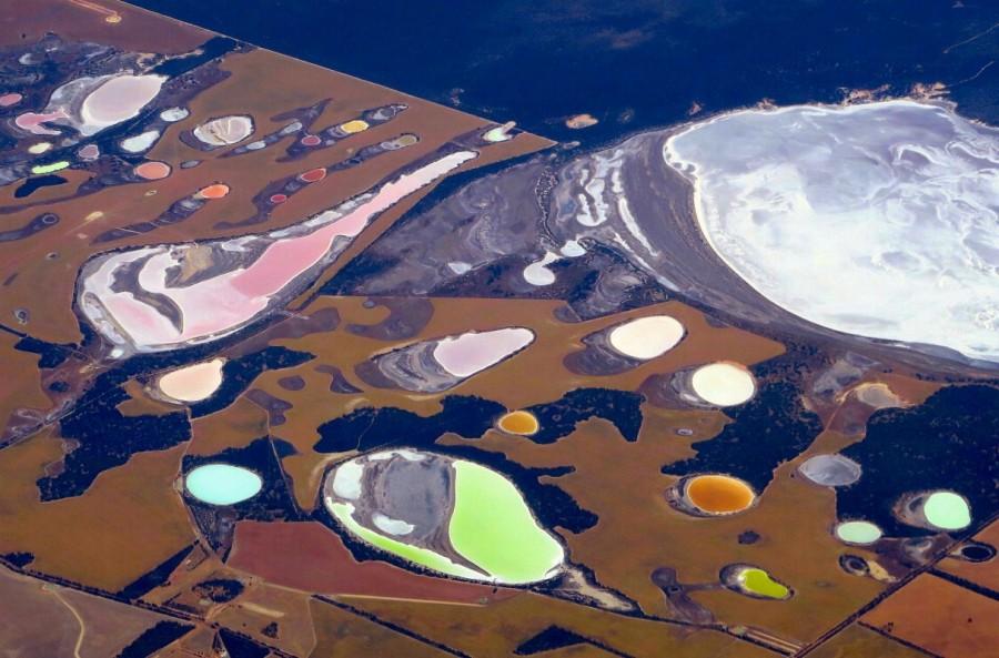
Salt pans and dams can be seen in farming areas located near Perth, in the southern region of Western Australian.
Credit: Reuters
6 of 10
![A small dam containing water is seen in a dry paddock next to another that has been affected by a fire on the outskirts of Melbourne. Australia from the air,Australia from air,Australia from above,Australia,Awesome Australia,Australia from above pics,Australia from above images,Australia from above photos,Australia from above stills,Australia from above pictures]()
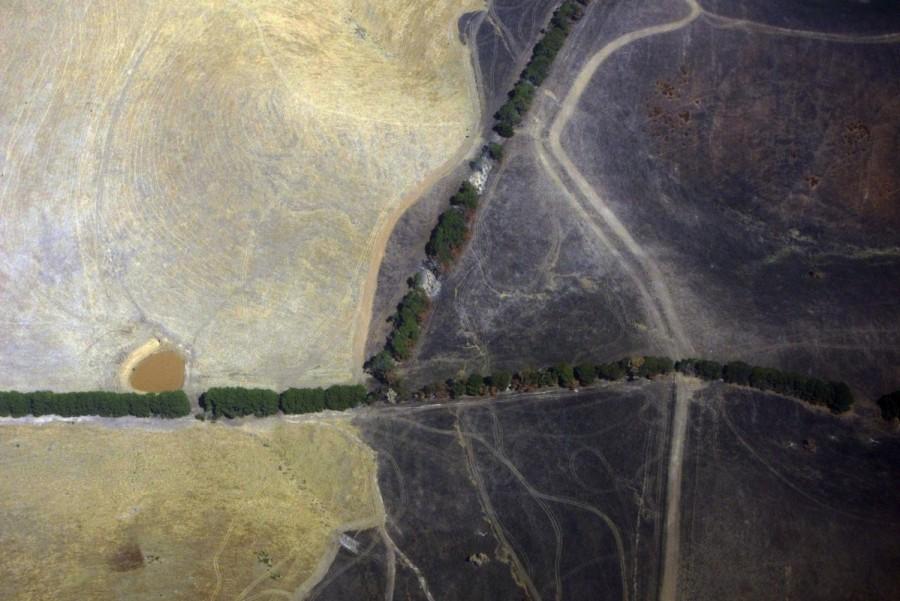
A small dam containing water is seen in a dry paddock next to another that has been affected by a fire on the outskirts of Melbourne.
Credit: Reuters
7 of 10
![River systems can be seen flowing near sand dunes in outback Queensland. Australia from the air,Australia from air,Australia from above,Australia,Awesome Australia,Australia from above pics,Australia from above images,Australia from above photos,Australia from above stills,Australia from above pictures]()
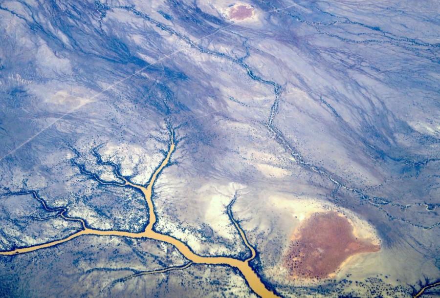
River systems can be seen flowing near sand dunes in outback Queensland.
Credit: Reuters
8 of 10
![A truck drives along a road in the Pilbara region of Western Australia. Australia from the air,Australia from air,Australia from above,Australia,Awesome Australia,Australia from above pics,Australia from above images,Australia from above photos,Australia from above stills,Australia from above pictures]()
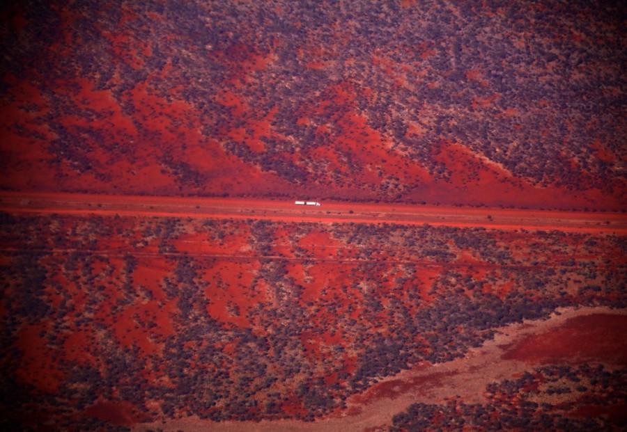
A truck drives along a road in the Pilbara region of Western Australia.
Credit: Reuters
9 of 10
![A dried-up river can be seen in the Pilbara region of Western Australia. Australia from the air,Australia from air,Australia from above,Australia,Awesome Australia,Australia from above pics,Australia from above images,Australia from above photos,Australia from above stills,Australia from above pictures]()
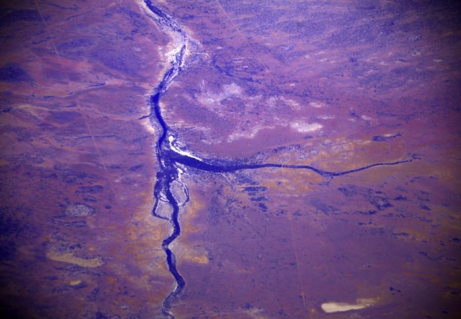
A dried-up river can be seen in the Pilbara region of Western Australia.
Credit: Reuters
10 of 10
![Burnt trees line a small creek in a paddock affected by a fire on the outskirts of Melbourne. Australia from the air,Australia from air,Australia from above,Australia,Awesome Australia,Australia from above pics,Australia from above images,Australia from above photos,Australia from above stills,Australia from above pictures]()
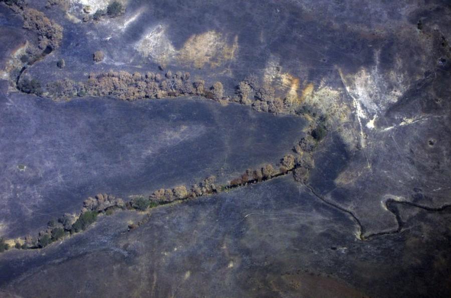
Burnt trees line a small creek in a paddock affected by a fire on the outskirts of Melbourne.
Credit: Reuters


