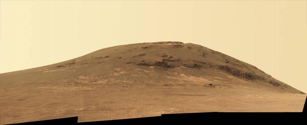
NASA's Mars Rover has finally reached the main destination -- Perseverance Valley-- it has to explore on the surface of the Red Planet during its two-year extended mission. The rover will explore an ancient fluid-carved valley, which is incised on the inner slope of a massive crater's rim.
Also Read: KalamSat: Indian teen Rifath Sharook builds world's lightest and smallest satellite
The automated motor vehicle had reached the upper end of the Perseverance Valley in early May and captured photos portraying parts of the region in greater resolution in comparison to the images which were taken from the orbit above the Red Planet.
"The science team is really jazzed at starting to see this area up close and looking for clues to help us distinguish among multiple hypotheses about how the valley formed," said Opportunity Project Scientist Matt Golombek of NASA's Jet Propulsion Laboratory.
The Perseverance Valley underwent an unknown process which led to the formation of the valley into the rim of Endeavour Crater billions of years ago.
As per guesstimations, flowing water or a debris flow in which a small amount of water lubricated a turbulent mix of mud and boulders could have been one of the processes that led to the rim formation. Another hypothesis reveals that it could have been a drier process such as wind erosion. The main objective of this mission with Opportunity is to find out what could be the exact cause of the rim formation.

The valley's upper end is present at a broad notch in the crest of the crater rim. And the rover team aims to explore the area by taking sets of the valley's photos from two widely separated points located at the dip in the rim.
The long-baseline stereo imaging will help in providing data for the most extreme detailed three-dimensional analysis of the Martian terrain. The valley spreads down from the rim's crest into the crater at a slope of about 15 to 17 degrees for a distance of about two football fields, a NASA statement revealed.
"The long-baseline stereo imaging will be used to generate a digital elevation map that will help the team carefully evaluate possible driving routes down the valley before starting the descent," said Opportunity Project Manager John Callas of JPL.
It could be difficult to reverse the route uphill while the Opportunity is partway down, hence finding a path with minimal hindrance across the valley will be crucial for driving the robotic rover. The rover would be used by the researchers to study the textures and compositions present at the top throughout the length and at the bottom in order to unearth about the history of the valley.
The stereo imaging is being assessed for drive-planning but the team of researchers plans to utilise the rover to analyse the area immediately west of the crater rim at the top of the valley.
"We expect to do a little walkabout just outside the crater before driving down Perseverance Valley," Golombek said.
This mission marks the beginning of 150th month since Opportunity rover's landing in Mars' Meridiani Planum region in 2004.
Areas on and near the western rim of Endeavour Crater have been explored by the Opportunity for almost half of the mission, ie 69 months, which led to the discovery of even older rocks. The diameter of the crater is equal to 22 kilometers (14 miles).
Opportunity arrived from the northwest at a point corresponding to about the 10 o'clock position on the circle if north is noon; Perseverance Valley slices west to east at approximately the 8 o'clock position, a statement by NASA revealed.
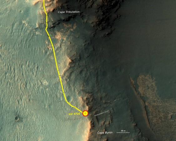
The rover has hustled southward to reach the crown of the valley in recent weeks. In mid-April it finished about two-and-a-half years on a rim segment called "Cape Tribulation."
In seven drives between then and arriving at the destination on May 4, it covered 377 yards (345 meters), bringing the mission's total odometry to about 27.8 miles (44.7 kilometers), the NASA statement concluded.


