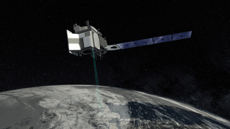
As the polar ice caps are melting rapidly on Earth due to global climate change scientists are doing all they can to study and probably prevent the phenomenon. Now, the American space agency NASA is gearing up to launch a latest high-tech satellite equipped with laser, which would study the state of Earth's changing ice sheets from above for three years.
The high-tech satellite, named Ice, Cloud and Land Elevation Satellite-2 or ICESat-2, is currently slated to be launched from Vandenberg Air Force Base in California on September 15. ICESat-2 will be carried out of the world, quite literally, aboard the Delta II rocket of United Launch Alliance. This voyage is also significant because it will be the last flight of the Delta II, which has witnessed over 150 launches throughout almost 30 years.
It will thoroughly observe and measure the change in individual ice patch's thickness from season to season. It is capable of recording the increases and decreases in ice sheets' thickness as small as half a centimeter.
#ICESat2 measures the height of ice, to see how it changes over time. It works by bouncing a laser off Earth's surface and then timing how long the laser photons take to return to the instrument. The ⏱ is super accurate, to within 1 billionth of a second. pic.twitter.com/xs8mVMbT3V
— NASA Earth (@NASAEarth) August 22, 2018
"The areas that we're talking about are vast — think the size of the continental US or larger — and the changes that are occurring over them can be very small. They benefit from an instrument that can make repeat measurements in a very precise way over a large area, and that's why satellites are an ideal way to study them," stated a NASA scientist Tom Wagner. Wagner is studying the world's ice.
Along with understanding the changes in polar ice caps, the satellite will help the scientists understand the world's forests better as well.
ICESat-2 costs more than $1 billion and it is as big as a Smart car. The satellite will follow NASA's two earlier major projects, which were intended towards monitoring the ice sheets' thickness as well. The new satellite is expected to provide the scientists with more detailed information than the previous missions.
The satellite’s laser shines at 532 nanometers, which looks bright green. The instrument splits the laser into six beams, which helps cover more ground and show how steep glaciers are. ? pic.twitter.com/I5skbUUMmL
— NASA Earth (@NASAEarth) August 22, 2018
Once the satellite embarks upon its journey, the scientists on the ground would receive plenty of new information about the melting ice sheets on Earth.


!['Had denied Housefull franchise as they wanted me to wear a bikini': Tia Bajpai on turning down bold scripts [Exclusive]](https://data1.ibtimes.co.in/en/full/806605/had-denied-housefull-franchise-they-wanted-me-wear-bikini-tia-bajpai-turning-down-bold.png?w=220&h=138)


