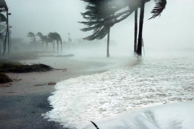
A potential double whammy for the U.S. Gulf Coast, according to the National Hurricane Center (NHC) this week. The northern Gulf Coast is bracing for two hurricane back-to-back strikes - Laura and Marco. Meteorologists have set their sights between Louisiana and East Texas.
First up, Marco strengthens from a tropical storm to a category 1 hurricane tomorrow, bringing fierce gusty winds, torrential rains and ferocious storm surge, also landfall in certain parts of Louisiana.
#Marco has become a hurricane, according to data from the Air Force @403rdWing Hurricane Hunters. Maximum winds are 75 mph (120 km/h) with higher gusts. https://t.co/MPtF0KuhE3 pic.twitter.com/o7GbutfMHU
— National Hurricane Center (@NHC_Atlantic) August 23, 2020
Data from an Air Force Reserve Hurricane Hunter aircraft warns of Marco Hurricane with gusty winds at 75mph (120km/hr) expected along portions of the U.S Gulf Coast on Monday, followed by Tropical storm Laura, impacting the same Marco hit areas at 96mph.
Tropical Storm Laura will become a hurricane, creating landfall near Louisiana in the United States late Wednesday or early Thursday this week. The successive blows along the U.S gulf coast with storm surge inundation and rising water levels leave no preparation time - as one subsidies, the next follows with more vigour.
Places on high alert by the NHC
The National Hurricane Center (NHC) warns of "life-threatening storm surge" with Marco getting closer to the U.S Gulf Coast. The storm surge warning has been issued to cities across the coastal belt to include Louisiana, Morgan City, Mississippi and east to Ocean Springs.
Marco is expected to bring "a tremendous amount of rain, not just to Louisiana, but areas of Mississippi, Alabama and even Florida," CNN reports.
As Marco subsides post landfall in Louisiana and parts of Florida, tropical storm Laura follows, moving with fortified strength and vigour to affect the same affected parts along the U.S Gulf coast.
Laura comes across as a more dangerous storm, classified under Category 2 and higher by the National Hurricane Center, bringing heavy torrential rains with whipping maximum gusty winds at the speed of at least 96 mph.
The impact of Laura remains uncertain, but according to forecasts the landfall is plausible over a wider zone, spanning from the Central Texas coastline east toward coastal Mississippi, a news report stated.
There is a danger of life inundation with rising water moving inland from the coastline over the next three days. The storm surge height is anticipated to be of 4 to 6 feet for Biloxi, Mississippi, and Grand Isle, Louisiana.
Will New Orleans be impacted by the hurricane, storm and gusty winds?
Considering New Orleans is not actually closer to the coast, it will be indirectly impacted by Lake Pontchartrain expected to experience surge heights of 2 to 4 feet approximately. However combined with 4 to 6 inches of rain, New Orleans being shaped like a bowl could see flash flooding on Monday. But the city levee system is prepared to protect Florida from floods.
JUST IN: Grand Isle orders mandatory evacuation beginning at 9 a.m. due to the approach of #Marco & #Laura. 4-6 feet of surge forecast from Marco. Laura is TBD depending on exact track, intensity. #LAwx pic.twitter.com/xROjRb5FHS
— Steve Caparotta, Ph.D. (@SteveWAFB) August 23, 2020
Grand Isle, in extreme southeastern Louisiana, is under a mandatory evacuation order. Since the track forecast for Laura shifted Saturday night, Houston needs to pay special attention to Laura.
"Five named tropical systems have made landfall along U.S. shores in 2020. If Laura and Marco follow suit, as forecast says, then 2020 will break the record for the most continental U.S. landfalls in a single year," a news report stated.


