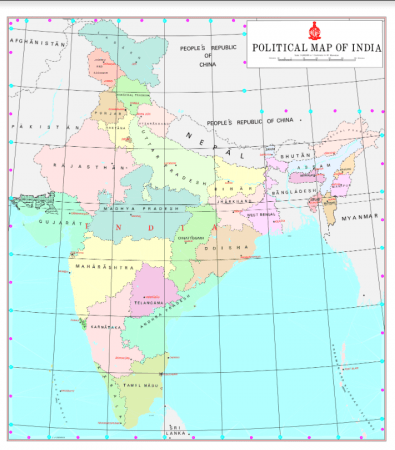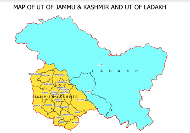
The government of India on Saturday, November 1, released the new political maps of the Union Territory of Jammu and Kashmir and Union Territory of Ladakh. Now, India has 28 States and nine Union Territories.
The two Union Territories formally came into existence on October 31 this year. Here's the map showing the administrative boundaries of the newly formed UTs of Jammu and Kashmir and Ladakh.

The list of Union Territories in India:
1. Andaman and Nicobar
2. Chandigarh
3. Daman and Diu
4. Dadar and Nagar Haveli
5. New Delhi
6. Jammu and Kashmir
7. Ladakh
8. Lakshadweep
9. Puducherry
Indian states:
1. Andhra Pradesh
2. Arunachal Pradesh
3. Assam
4. Bihar
5. Chhattisgarh
6. Goa
7. Gujarat
8. Haryana
9. Himachal Pradesh
10. Jharkhand
11. Karnataka
12. Kerala
13. Madhya Pradesh
14. Maharashtra
15. Manipur
16. Meghalaya
17. Mizoram
18. Nagaland
19. Odisha
20. Punjab
21. Rajasthan
22. Sikkim
23. Tamil Nadu
24. Telangana
25. Tripura
26. Uttar Pradesh
27. Uttarakhand
28. West Bengal


