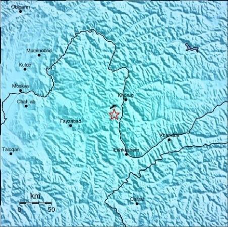
A moderate earthquake measuring 5.5 on the Richter scale rocked Kashmir, India on Thursday.
The tremor struck at 12:06:36 PM on Thursday according to United States Geological Survey (USGS). The epicenter was located at Hindu Kush region, Afghanistan.
There are no reports of casualties and damages so far.
Kashmir is prone to earthquakes. An earthquake measuring 5.8 on the Ritcher scale hit the region on March 12 this year. The 2005 Kashmir earthquake measuring a magnitude of 7.6 killed more than 1000 people.
The seismic zoning map of India has placed Kashmir in the "Very High Damage Risk Zone". Other places that fall in this zone include North-Eastern region, Punjab, the Rann of Kutch and the western and central Himalayas.
According to USGS, seismicity in the Himalaya dominantly results from the continental collision of the India and Eurasia plates, which are converging at a relative rate of 40-50 mm/yr. Northward underthrusting of India beneath Eurasia generates numerous earthquakes and consequently makes this area one of the most seismically hazardous regions on Earth. The surface expression of the plate boundary is marked by the foothills of the north-south trending Sulaiman Range in the west, the Indo-Burmese Arc in the east and the east-west trending Himalaya Front in the north of India.
USGS report says that beneath the Pamir-Hindu Kush Mountains of northern Afghanistan, earthquakes occur at depths as great as 200 km as a result of remnant lithospheric subduction. The curved arc of deep earthquakes found in the Hindu Kush Pamir region indicates the presence of a lithospheric body at depth, thought to be remnants of a subducting slab. Cross-sections through the Hindu Kush region suggest a near vertical northerly-dipping subducting slab, whereas cross-sections through the nearby Pamir region to the east indicate a much shallower dipping, southerly subducting slab. Some models suggest the presence of two subduction zones; with the Indian plate being subducted beneath the Hindu Kush region and the Eurasian plate being subducted beneath the Pamir region. However, other models suggest that just one of the two plates is being subducted and that the slab has become contorted and overturned in places.


